Archive of U.S. Daily Weather Maps from 1871 to the present time.
I posted about this great website in a very recent daily weather post of mine, earlier this week, but Nathan encouraged me to make a separate blog about it. There is endless possibilities and fun that can be had by viewing and studying daily weather maps from the past. Looking up the weather map for the day you were born, verifying storm data/dates of memorable occasions in the past, settling disagreements about when a big snowstorm occurred, and what the synoptics looked like with it are just a few possibilities searching this website.
http://library.noaa.gov/Collections/Digital-Documents/US-Daily-Weather-Maps
This website will explain about the archive the NOAA Central Library and others scanned and built for the U.S. Daily Weather Map. You must note that a unique file viewer is necessary to download first to use to look at, download, save and print the files. Links and instructions can be found on this website. The viewer is easily to work with, and allows you to zoom in and out, without loss of resolution that I could notice using reasonable levels. You cannot do this on your phone as far as I can see, you really need a desktop to work this through, esp. to see the fine detail of each daily weather map. Sorry to those who may know all about this and have already done this.
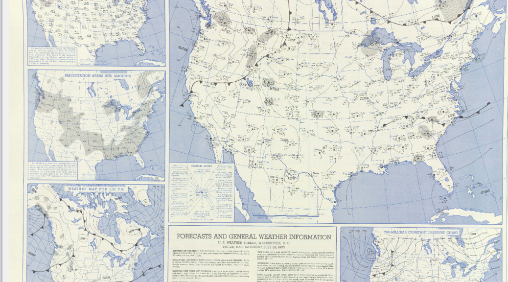
Kevin P.S. The attached image is a copy of the Daily Weather Map for the day I was born – July 29 1950 to show you a rough example. I had to save it for posting here as a snip, a png file. When you display it that way, you lose resolution, particularly if you want to zoom in and see all the details (as explained above). I could not display the viewer file that is generated by the specialized DjVu viewer – you must do that yourself off of the website and after you download the viewer.